"Akit is the man. He knows Clipper." (spenta)
"It’s a fantastic blog for any San Franciscan."
(Kevin)
"Your blog is always on point, and well researched!" (Nina Decker)
"Everyone's favorite volunteer public policy consultant..." (Eve Batey, SF Appeal)
"You are doing a great job keeping on top of Translink stuff. Keep up the good work!"
(Greg Dewar, N Judah Chronicles)
"...I don't even bother subscribing anywhere else for my local public transportation info. You have it all..."
(Empowered Follower)
"If anyone at City Hall wants to make public transit better for all San Franciscans, it would be wise to follow Akit religiously...
or, better yet, give him a job."
(Brock Keeling, SFist)

Thursday, November 26, 2009

UPDATE: Google Maps Now Includes Muni's Upcoming Service Changes


This is an interesting piece of news, Google Maps updated their "transit planner" for Muni when you tell the system you plan to take a trip on or after 12/5/09.

I noticed this change on the map posted on a recent entry on my blog addressing Muni about why new bus and train schedules are not posted for the public to view.

To give you a particular example, let's say I wanted to do these criteria:
  1. Departure date: 12/5/09
  2. Departure time: 10AM
  3. Starting point: 9th Avenue and Irving (Inner Sunset)
  4. End point: 4th and King
Now, if this trip were to happen before 12/5, it is obvious I would take the N-Judah for a direct ride (no transferring) to 4th and King streets. Muni's service changes website states that the N-Judah will not operate to Caltrain on weekends starting on 12/5 and I should transfer to a T-Third train along the subway portion of the N-Judah line.

Let's see what Google Maps created for me:

View Larger Map

Google Maps now tells me to take the N-Judah and transfer to the K-Ingleside/T-Third line at Embarcadero, and it will be a 10 minute transfer period until the next K/T train will arrive.

--------------------

If you recall from my recent complaint about the 18-46th Avenue not working on Google maps and telling me to take the 91-Owl at 4AM on 12/7, I have a surprise... the map has been updated! See below.


Google now instructs me to take the 18-46th Avenue along the modified route (the former Ocean Beach branch of the 38-Geary) at 7:27AM, and I will arrive at SF State University at 7:57AM.

--------------------

What does this all mean Akit? These updates to Google Maps means that it now officially works if you need to plan to get around the city after 12/5/09.

511's transit planner IS NOT YET READY and the SFMTA has NOT published time schedules for those who don't want to use a trip planner.

The power of one person can change city politics for the good. I'm proud of my accomplishments, and I thank my fellow Tweeters (like munialerts, munidiaries, and whole_tost) who helped spread the word around to hundreds or even thousands of people around San Francisco.

Wednesday, November 25, 2009

Akit's Furlough Adventure #7: Japantown


Being on furlough this week is sort-of boring and I'm trying to find things to kill time. I thought it would be fun to go to one of my favorite neighborhoods, Japantown!

San Francisco's Japantown is home to a lot of great Japanese restaurants, non-profit community organizations, great hotels, and a heck of a shopping experience.

I know if you have gone to J-Town, you have been to Ichi Ban Kan, a place full of housewares, food products, personal grooming supplies, and ice cold beverages for a low price. They even carry unique items from Japan like Hi-Chews in a larger pack than the ones made for the United States distributors. They even carry unique flavors including peach.

Daiso recently opened-up in Japantown as well, and they are a huge Japan based worldwide chain store famous for items at a low price. Around the stores in the United States, they sell 95% of their products for only $1.50. One of their popular items are the keychain lights (in photograph) that retail at places like Brookstone for about $15, but it's only $1.50 at Daiso. The store in Japantown is SMALL and the one in Serramonte is huge with a big variety of items.

Between the two places, I like Ichi Ban Kan better with the large food variety. But I will admit that I like Daiso for the affordable plastic containers and such, and I prefer the one in Serramonte over the Japantown location because they accept credit cards.


As for lunch, a hearty meal for under $10 at Mifune includes cold soba (buckwheat) and udon (rice) noodles with tempura and their famous dipping sauce.

Have a happy Thanksgiving! If you are going out for Black Friday shopping, get there early and dress warmly.

Tuesday, November 24, 2009

Hey Muni, Where's the New Route Schedules?


Everyone in the city knows about the major service changes happening on Saturday, December 5th, unless if you don't understand English such as the Chinese Americans in Visitation Valley who didn't learn about it until Marlene Tran started rallying the troops.

(On a side note, Ms. Tran is a really great person to meet. I met with her during my first semester in Graduate School when she was teaching ESL on behalf of City College)

What really scratches my head is that both 511 and Google Maps (for public transit) does not have any information whatsoever about the route terminations and changes.

Here's a particular example: on Google Maps, I want to go from 33rd Avenue and Geary Blvd. to Lake Merced and Font Blvd and arrive at 8:00AM on 12/7/09. Easily, the 18-46th Avenue is the route I will have to take to directly get there (even if the line gets re-routed). Instead, Google Maps suggests I take the 38-Geary and the 91-Owl at 4AM to get to SF State three hours early. Google basically deleted every bus and train route that is being changed and kept the ones that will not be changed.

UPDATE: 11/26: Google maps updated their Muni routes for after 12/5/09 including time schedules. What you see below in this updated Google map shows the revised route for the 18-46th Avenue.


View Larger Map
Full description including what times I have to catch the bus are posted here.

In 511's trip planner program, the route changes and schedule changes have not been fixed. If I were to take the exact trip as I did for Google, it will tell me to take the 18-46th Avenue, but it takes the pre 12/5/09 route that goes around the Cliff House.

The public wants a time schedule NOW. Not everyone takes a major bus line that comes around every 5-10 minutes; I wait up to 20 minutes for the 18-46th Avenue and I have the right to know when my bus is scheduled to arrive so I can minimize waiting in the freezing cold.

If a time schedule does not get released soon, Google Maps and 511 will become USELESS.


Lastly, Muni should get their staff out into the streets putting up notices of line terminations or major changes at bus stops that will be affected NOW. There's a little more than one week left.

Monday, November 23, 2009

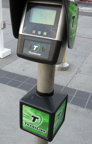
TransLink Management Meeting Update 11/23 (The Good Stuff)


TransLink's management board had their meeting earlier today and the MTC always posts their agenda online and also a couple of presentations by the TransLink staff to the board.

For the past few meetings, I've been giving you all the juicy details and skipping over the garbage that the public doesn't want to hear (mostly about dollars and cents).

So here's Monday, November 23rd's great information you should know:
  • In October 2009, there was 40,000 transactions, and is over double the amount from last year.
  • As of November 5th, 88 Samtrans buses are equipped with TransLink and continuing. Gillig buses are being pre-wired during the bus building process so TransLink equipment can be installed faster.
  • VTA will start installation in January 2010. It is estimated to be "revenue ready" by April 15th, but the installation may start late.
  • Installation of add value machines at the Transbay Temporary Terminal will be done in early December.
  • For those who transitioned from EZ Rider to TransLink, BART sent out surveys to those people.
  • SFMTA/Muni is continuing to distribute discount TransLink cards (elderly, disabled, and youth).
  • BART is still working on having their ticket machines be able to add funds and should be ready in late 2010.
  • VTA and Caltrain are also working on having their ticket machines to add-value, but has no date of planned completion.
  • TransLink is looking into a contactless only option (no gold chipped cards and no need to insert cards into slot).
  • The elderly/disabled Muni pass program that allows BART access is underway and TransLink is looking into integrating it into their program.
  • TransLink is looking into purchasing handheld readers for Cable Car usage.
  • A proposal by TransLink to add card readers at exit points on the Muni Metro subway sections.
  • Caltrain's monthly parking permit program is considering to be integrated with the TransLink card.
  • The TransLink contractor is working on a computer programming script for transaction history requests so it can be executed faster. TransLink claims they are able to save 500 man hours by taking advantage of computer technology.
Just looking over the documents shows a lot of the same material mentioned from previous meetings.

I don't agree with the idea of adding card readers at exit gates on Muni, unless if the data is being used to track rider patterns to improve service and/or make it easier for fare inspectors.

Lastly, I like the idea of TransLink getting history reports quicker and I hope they will be able to fully automate it online so everyone can review their history reports instantly instead of the few day waiting period.

Wednesday, November 18, 2009

Update: Muni's 18-46th Avenue Passenger Shelters Removed

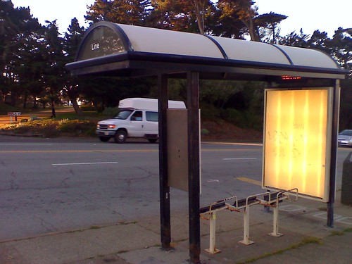
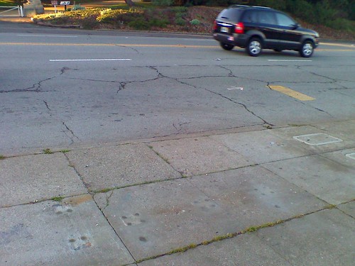
Within 48 hours of my recent posting about the removal of key components of the bus shelters on the 18-46th Avenue bus lines for the soon to be defunct route covering Geary and Pt. Lobos, Muni has removed all the shelters on that route segment.

18-46th Avenue at Pt. Lobos & 48th Ave
Before...

The Shelter for the 18-46th Avenue is Gone
AFTER

Here's all the before & after photos I have taken:


I'm disappointed at Muni for removing the shelters way before the route changes are in effect. It's freezing cold at the stops near the Cliff House and the shelters are the only protection.

Monday, November 16, 2009

Muni already dismantling 18-46th Avenue bus stops


The above slide show is Muni's preparations for the end of the 18-46th Avenue segment that serves Geary and Pt. Lobos. While the route changes are about 20 days away, Muni has already removed the glass, route map, and lettering indicating it is a bus stop designated for the bus line.

To make matters worse, within a day of the removal of items, graffiti artists tagged-up the two bus stops at Pt. Lobos and 48th Avenue.

Just removing the glass makes things look sad for one of my favorite bus lines that takes me to and from work at SF State University. There's no protection from the elements and I was freezing my ass off waiting for the bus today.

Did Muni ever put a notice on these bus stops that they will be terminated on December 5th? No.

Friday, November 13, 2009

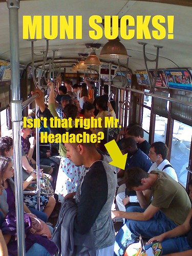
Is the Muni Metro the butt of jokes about the agency?


It's almost every single day, there's something wrong with Muni metro. Just today, SF Appeal reported the automatic train control systems was not functioning properly and Muni had to supplement the backed-up trains with bus shuttles.

I feel it is universally understood that Muni Metro is one of the big disasters about this agency, and its troubled past tells a big story:
  • Before the metro system, PCC cars ran along Market street and served the current metro routes of Muni (except the Embarcadero extension and the "T" line). The K, L, and M lines went through the Forest Hill tunnel by entering/exiting at West Portal, and at Market and Castro.
  • When the metro system and BART was being constructed, the PCC cars ran on temporary tracks because the agency used the "cut and cover" method. Basically, it means digging a huge trench and replacing the roadbed.
  • Once the metro started, the new Boeing cars was placed into service, and soon showed the major flaws about the system. The stations were high platform, and became a major issue for people with disabilities exiting along the surface routes, and while the cars were OK for use in the 80's, as the population grew, things didn't get pretty.
  • Muni metro was able to run manually and four train cars can be connected with the Boeing set, but customer complaints of the lack of air conditioning and the limited number of subway boarding doors made the cars a total piece of garbage. Muni sought the next generation of cars.
  • Muni awarded the contract to Breda to build the LRV 2 and LRV 3 generation of metro cars and was much more roomier with air conditioning and more room for passengers. But this also had problems: it was overweight, too long to operate with four cars, allegedly damaged the foundations of homes, noisier than the Boeings, and the cost of each vehicle was starting to climb as the city was paying to fix the problems associated with the earlier generation of Breda cars.
  • At the same time these new cars are being rolled-out, Muni added the automated train program for the subway portion and created the infamous "meltdown." This was caused by two major factors: A mix of automatically and manually operated trains in the system, and the Boeings couplers were not compatible with the Bredas to make longer trains.
  • After several years, we reach today; the automated system works better, but the Breda trains are starting to show their scars. The air conditioning on some of the train cars are totally inoperable and doesn't allow any cool air to circulate around the train, trains are more prone to breaking down, speed has been dramatically reduced on in the tunnel portion between Forest Hill and Castro, and there have been a number of accidents including the crash at West Portal.
I have to ask myself, with such a bad rap about our metro system, why is there a plan to build BRT corridors and have them ready for light rail service? When you think of light rail, all you can think about is the terrible metro service, but for me, installing light rail may be a bad idea because at least buses can go around each other when one is inoperable, a light rail car that is down is stuck and you have to be lucky if there is a track switch somewhere nearby.